
Overview
The Geostationary Operational Environmental Satellites (GOES) operated by NOAA are essential for continuous observation of atmospheric conditions, severe weather events, and environmental changes. The GOES satellites provide high-resolution imagery and atmospheric measurements, which are crucial for accurate weather forecasting, climate monitoring, and disaster management. Their geostationary position allows them to monitor the same area continuously, providing real-time data that is vital for tracking the development and movement of storms, hurricanes, and other weather phenomena.
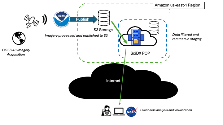
This project focuses on harnessing the real-time data streaming and analysis capabilities of the NOAA GOES satellites. By leveraging advanced data processing techniques and state-of-the-art analytical tools, the project aims to enhance our understanding of weather patterns and environmental changes. This initiative not only supports scientific research but also contributes to public safety by improving the accuracy and timeliness of weather predictions and alerts. The collaboration with the Scientific Computing and Imaging Institute at the University of Utah ensures the integration of cutting-edge computational methods to optimize the use of GOES data for various applications.
Explore the Jupyter Notebook demo for a detailed walkthrough
Objective
NOAA’s GOES program plays a critical role in monitoring weather, climate, and environmental phenomena across the Western Hemisphere. The advanced capabilities of the GOES satellites enable real-time data streaming and analysis, providing invaluable information for meteorologists, climate scientists, and emergency response teams.
Collaborators
This use case highlights collaboration between the University of Utah, NOAA, and the NSF.